Behind the Scenes: The Map
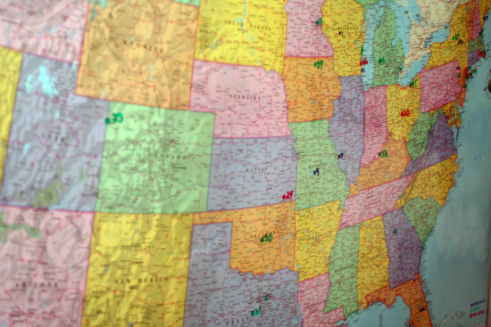
 Sure we're using some fun technology to put the movie together, and of course YouTube and Facebook, etc are key to letting people know about the project. But the one item that's probably more important to this project than any other is... the map.
At the end of the day, it's this 4x5 map that chronicles where different objects from the fair can be found today, where they were previously, and how to get to them today. It's no easy task: we don't have a limitless travel budget, so it is key to try to pack as many things into single trips as we can. However the far-flung locations of many items make it difficult to plan for just a few trips to get to everything.
So if you've ever wondered what we're looking at when we're not posting the site, it's this map: adding locations, marking the ones we've already visited, etc. Sure there are tons of digital mapping solutions, but this is the quickest, easiest way to see at a glance where we've been, and where we're headed.


 Ryan Ritchey
Reader Comments (1)
Is the marker at the Illinois/Missouri border for the Lincoln statue from the Illinois pavilion?